
Summary
Ložišća is a stone-built settlement on a steep slope in western Brač. It grew through migration from Bobovišća; its landscape is shaped by vineyards, olive groves, dry-stone walls and Ivan Rendić’s bell tower.
The church, water-collection site and road to the harbour explain how this farming village lived.
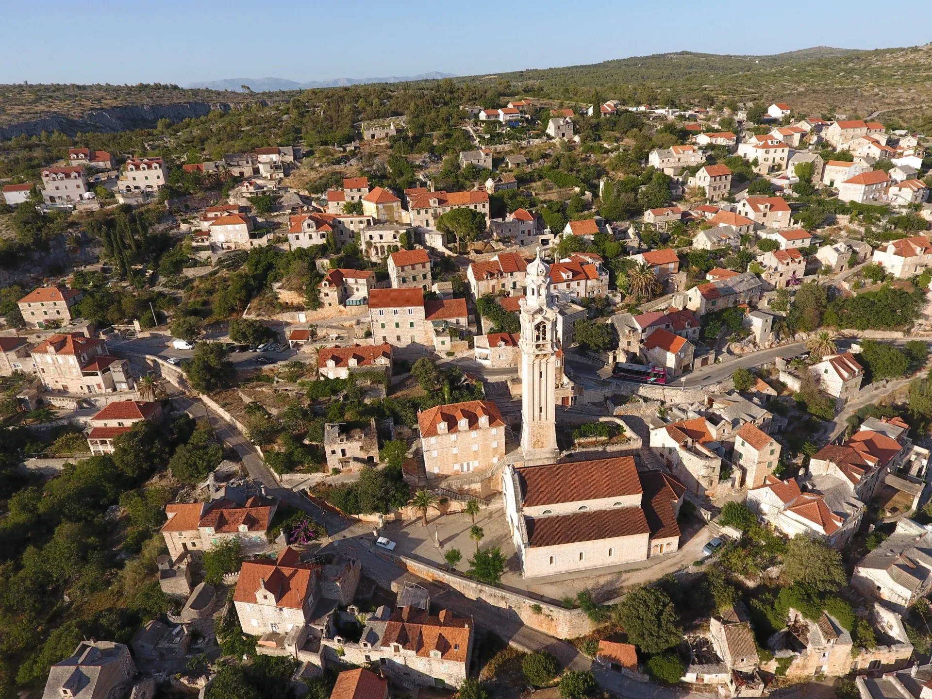
Velo selo on the slope
Ložišća developed in the 18th century through migration from Bobovišća. The local name Velo selo (Big Village) distinguishes it from its older neighbour. Houses line the steep slope: living spaces, cellars and entrances are adapted to the gradient, while the more fertile hollows were left for cultivation.
Church and community investment
The Church of St John and St Paul was built in 1820. Its slender bell tower was designed by Ivan Rendić and became a recognisable landmark of the village. The building, a shared investment of the local community, dominates the public space, while the surrounding houses preserve more modest forms of everyday living.
Land and water
Stone clearance, dry-stone walls and terraces made it possible to grow grapes and olives. Donji pisk (the lower water-collection site), also called Stara voda (Old Water), collected rainwater in basins and stone troughs for livestock. This water infrastructure explains the village’s pastoral life as clearly as the terraces show the work of farming families.
Road towards the sea
The Franz Joseph Stone Bridge crosses a ravine on the old route towards Vičja luka. The bridge is not evidence of a permanent river; it provided passage across a torrent-prone hollow. The connection with Bobovišća na Moru shows how this inland farming community relied on a coastal harbour.



