
a project bymojBrač

Places map

Places and stories of Brač

Explore the places, heritage and local producers of Brač. Suggest an addition and help build the island’s atlas.

History and architecture

Francis Joseph Stone Bridge

Veliki dolac · between Ložišća and Vičja lukaOther names: Most cara Franje Josipa, Most Franje Josipa, Most u Velikom dolcu, Kameni most Franje Josipastone bridge · 1898Bridge coordinates according to the OpenStreetMap/Wikimedia Commons map record

Summary

The Francis Joseph Stone Bridge crosses the head of the Veliki dolac gorge in the interior of Brač. It is an unusual island infrastructure monument, spanning a torrent gully on an island without permanent rivers.

Built in 1898 during Austrian rule; its name refers to Emperor Francis Joseph I.
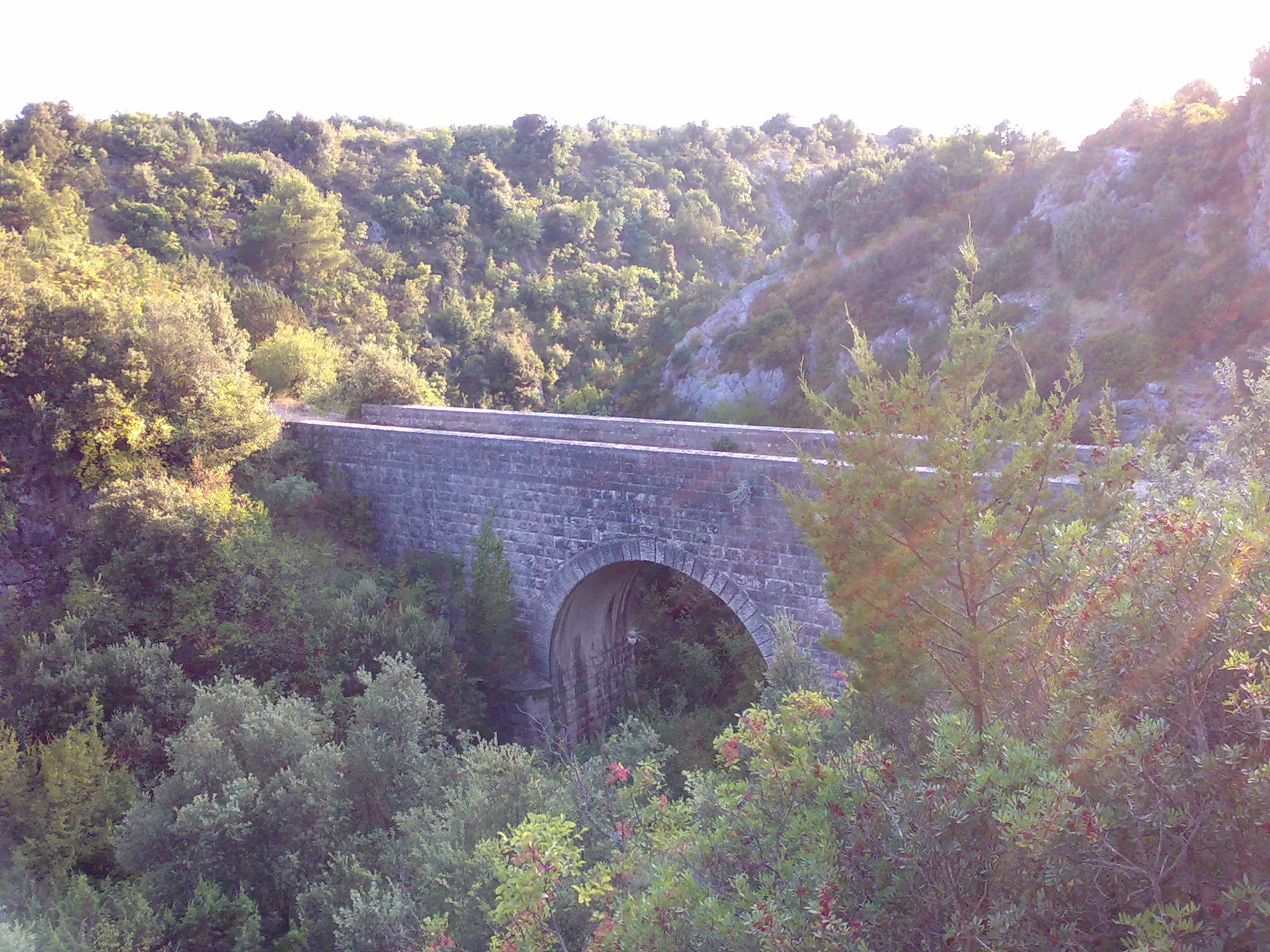
Francis Joseph Stone Bridge above Veliki dolac
Francis Joseph Stone Bridge above Veliki dolac · Denny · Wikimedia Commons · CC BY-SA 4.0 · licence

History and context

The stone bridge is at the head of Veliki dolac, on the old route between Ložišća and Vičja luka. It was built in 1898 in honour of the fiftieth anniversary of Emperor and King Francis Joseph I's reign, according to Croatian National Tourist Board material. Islanders commonly call it the Francis Joseph Bridge.

What the site reveals

The bridge spans a ravine that carried torrents after heavy rain. Its construction is part of the island's infrastructure heritage from Austrian rule and shows how island roads had to accommodate watercourses that were occasional but powerful. The suggestion that the permanent river Elafuza once flowed here is presented as a hypothesis, not an established fact.

Location and visiting

A footpath leads to the bridge from Ložišća through olive groves; the ground is uneven and may be slippery after rain. The point marks the bridge, not the start of the path or a car park. Preserve the stone structure and use existing paths.


Visitor contributions

Do you know more about this entry?

A photo, an old postcard, a source link or local knowledge can help make the atlas more complete.

Schematic map of Brač with place markers

Every contribution is reviewed before publication.

Religious buildings
4 places

Separate map · local production

Find local producers

A map of family farms and other local producers on Brač. Browse by product type — olive oil, honey, cheese, cosmetics and more — and find basic information, contacts and official websites.

Open the producers’ map →
Local knowledge · Explore Brač

Help document Brač.

Do you know an old name, have a photo, know the location or have a source to share? Your contribution can enrich the island’s public atlas.

Suggest a connection between places →
Schematic illustration of a map with place markers
MOJ BRAČ · SECURE SIGN-IN

Sign in to Explore Brač

We send a one-time code to your email so you can save favourites. You do not need a password or separate registration. Your email and favourites list are stored in the Atlas database.