
a project bymojBrač

Places map

Places and stories of Brač

Explore the places, heritage and local producers of Brač. Suggest an addition and help build the island’s atlas.

History and architecture

Kaštel Cerinić in Splitska

Splitska · east side of the harbourOther names: Kaštel Cerineo u Splitskoj, Kaštel Cerinić u Splitskoj16th centuryMap reference: boundary of protected cultural property Z-4931; verify the entrance and access separately.

Summary

The fortified Cerinić family complex on the east side of the harbour in Splitska combines a residence with the protection of the family estate. An inscription records its restoration in 1577; this kaštel is a separate building from the family’s fortified residence in Škrip.

The coastal and Škrip fortified residences belong to the same family history, but they are different sites.
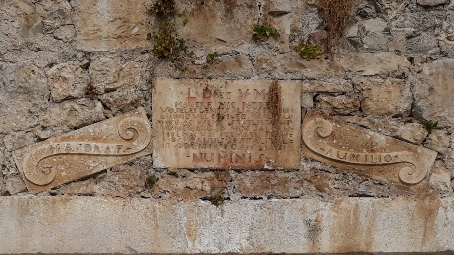
Inscription on Kaštel Cerinić in Splitska
Inscription on Kaštel Cerinić in Splitska · Argo Navis · licence

A fortified home by the harbour

The complex was built in the second half of the 16th century, when the coastal settlement was being fortified. The two-storey stone house is connected to a tower in the courtyard. An inscription mentions the Cerinić family and a restoration in 1577, so that year should be distinguished from any earlier building phases.

Sources: [1] [2]

The family and the settlement

The kaštel is part of the residential and defensive history of Splitska. Its importance is tied to the harbour and estates in the hinterland. Kaštel Cerinić in Škrip is a separate complex belonging to the same family heritage; comparing the two shows how prosperous families had a presence in several island settlements.

Sources: [2] [3]

Viewing from outside

The building is part of the historic residential fabric on the east side of the harbour. The official boundary of the protected cultural property is for orientation; it does not mark an entrance. Viewing the exterior does not imply entering a private house or courtyard.

Sources: [1] [2]

Visitor contributions

Do you know more about this entry?

A photo, an old postcard, a source link or local knowledge can help make the atlas more complete.

Schematic map of Brač with place markers

Every contribution is reviewed before publication.

Religious buildings
4 places

Separate map · local production

Find local producers

A map of family farms and other local producers on Brač. Browse by product type — olive oil, honey, cheese, cosmetics and more — and find basic information, contacts and official websites.

Open the producers’ map →
Local knowledge · Explore Brač

Help document Brač.

Do you know an old name, have a photo, know the location or have a source to share? Your contribution can enrich the island’s public atlas.

Suggest a connection between places →
Schematic illustration of a map with place markers
MOJ BRAČ · SECURE SIGN-IN

Sign in to Explore Brač

We send a one-time code to your email so you can save favourites. You do not need a password or separate registration. Your email and favourites list are stored in the Atlas database.