
Summary
Bol developed on Brač’s exposed southern coast below Vidova gora. Its history was shaped by wine growers, fishermen, seafarers and the religious community on Glavica, followed by the strong growth of tourism.
The donation of Glavica to the Dominicans in 1475 is an important point in the history of coastal Bol.
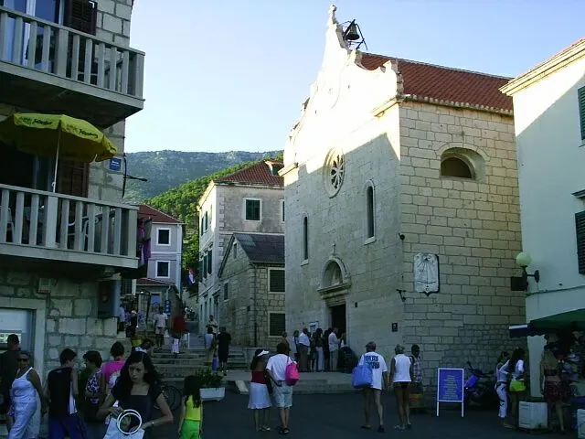
A settlement beneath the steep hinterland
Bol lies below Vidova gora on the southern coast, facing the open Hvar Channel. Medieval sources record the area’s name before today’s settlement had clearly taken shape. A 1475 donation to the Dominicans confirms the presence of a community of local residents and the importance of the Glavica peninsula.
Monastery and earlier sanctuary
The Dominican Monastery on Glavica developed from 1475 and became a spiritual and cultural centre. The Church of St John preserves an older sacred tradition and a stone interlace screen. The two buildings show that the area’s history has several layers and is not limited to the development of the modern waterfront.
Waterfront, work and public space
Wine growing, fishing and seafaring sustained families in Bol for a long time. The Loggia in Bol belongs to the public space by the harbour, while the Parish Church of Our Lady of Mount Carmel has served the community on its western side. In the 19th century, wine trading and emigration grew; from the 20th century onwards, tourism changed the economic weight of the settlement.
Landscape and art collections
Zlatni rat (Golden Horn) is the best-known coastal landform nearby, while Velo Koštilo (prehistoric hillfort) preserves traces of prehistoric observation over the southern slopes. The Branislav Dešković Gallery connects Bol with modern art. These sites belong to different stories: the natural shaping of the coast, early settlement and cultural life.



