
a project bymojBrač

Places map

Places and stories of Brač

Explore the places, heritage and local producers of Brač. Suggest an addition and help build the island’s atlas.

Archaeology · Nature

Velo Koštilo

above BolOther names: Veliko Koštilo, Koštilohistoric fortified positionApproximate location · based on a Google Maps marker

Summary

Velo Koštilo is a rocky height above Bol associated with hillfort remains and the surveillance of Brač's southern coast. It stands out in the steep landscape below Vidova gora.
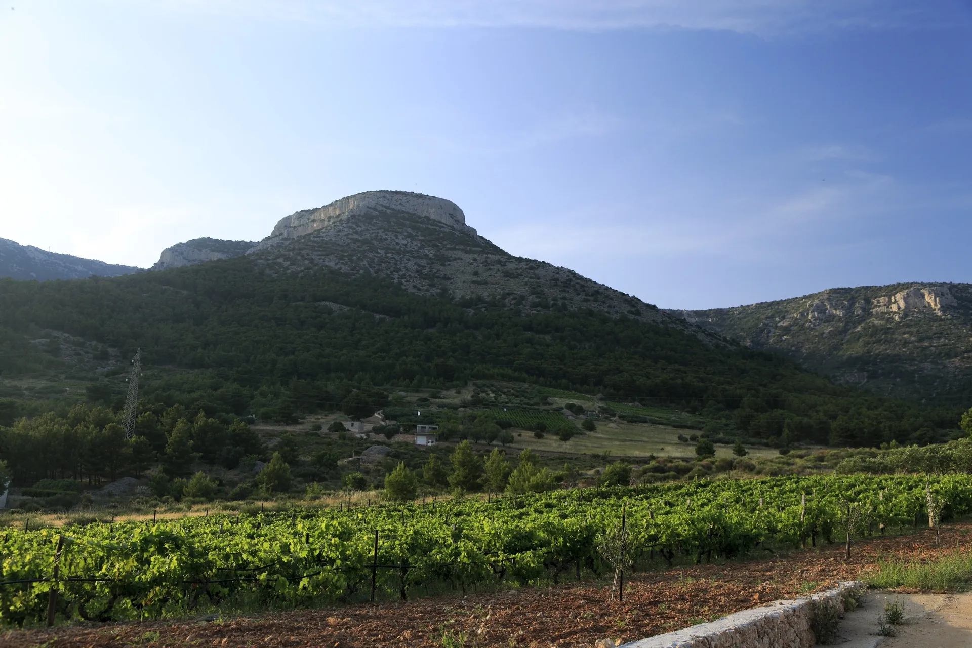
Velo Koštilo is a rocky height above Bol associated with hillfort remains and the surveillance of Brač's southern coast. It stands out in the steep landscape below Vidova gora.

Velo Koštilo above Bol
Velo Koštilo above Bol · Falk2 · CC BY-SA 4.0 · resized and converted to WebP · licence

Height above Bol

The Bol Tourist Board describes Koštilo as a fortified position with an Illyrian hillfort along the ridge above the settlement. A hiking route description from Bol towards Vidova gora mentions traces of a fort on hard-to-reach cliffs. The summit and the archaeological boundary may not correspond to the same point on the map.

Historical layers

The name Koštilo is associated with a fort or castle. Specialist references also include studies of Late Antique fortifications that mention this position. Dating individual remains requires distinguishing the hillfort period from later fortification; the general name does not confirm the age of every visible wall.

Access and visiting

Koštilo is in steep terrain above Bol. The hiking route to Vidova gora provides spatial context, but this does not mean every turn-off towards the fort remains is maintained or marked. Check the route and make sure you are prepared for steep, rocky terrain before setting out.

Visitor contributions

Do you know more about this entry?

A photo, an old postcard, a source link or local knowledge can help make the atlas more complete.

Schematic map of Brač with place markers

Every contribution is reviewed before publication.

Religious buildings
4 places

Separate map · local production

Find local producers

A map of family farms and other local producers on Brač. Browse by product type — olive oil, honey, cheese, cosmetics and more — and find basic information, contacts and official websites.

Open the producers’ map →
Local knowledge · Explore Brač

Help document Brač.

Do you know an old name, have a photo, know the location or have a source to share? Your contribution can enrich the island’s public atlas.

Suggest a connection between places →
Schematic illustration of a map with place markers
MOJ BRAČ · SECURE SIGN-IN

Sign in to Explore Brač

We send a one-time code to your email so you can save favourites. You do not need a password or separate registration. Your email and favourites list are stored in the Atlas database.
