
a project bymojBrač

Places map

Places and stories of Brač

Explore the places, heritage and local producers of Brač. Suggest an addition and help build the island’s atlas.

Settlements · Archaeology

Straževnik – historic settlement

Between Pražnica and Gornji HumacOther names: Straževnik – povijesno naseljeMiddle AgesThe pin marks the general area based on the source description. The exact location of the structure and the approach have not been confirmed; check locally before setting out.

Summary

The deserted medieval settlement of Straževnik bears witness to an earlier distribution of population in the interior of Brač. The most recognisable surviving part of its centre is the Church of St George.

The disappearance of the village does not mean that all its churches, objects and family connections disappeared.
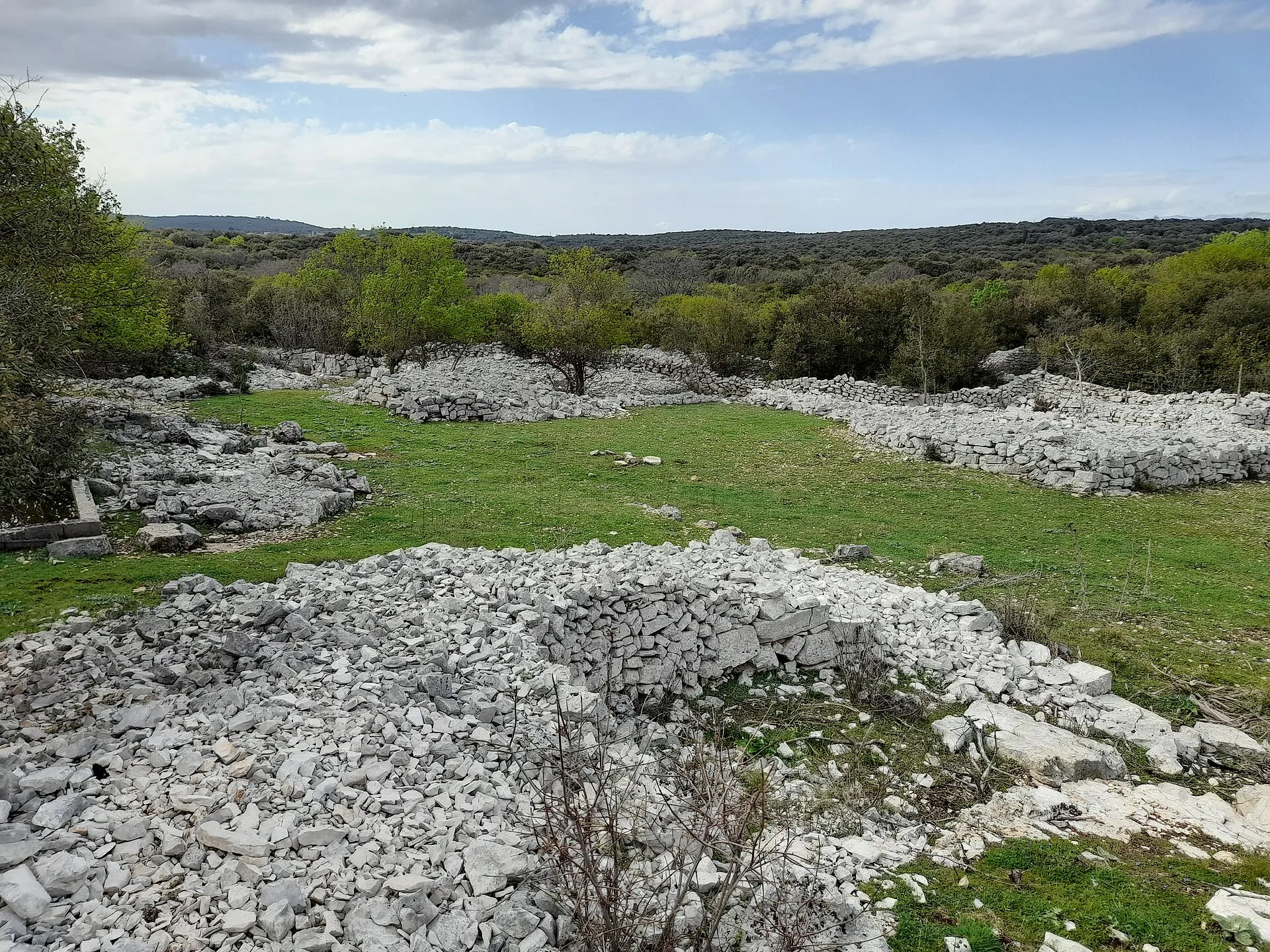
Remains of stone walls and landscape of Straževnik
Remains of stone walls and landscape of Straževnik · Argo Navis · licence

A settlement in historical documents

Straževnik and the Church of St George are mentioned in a document from 1111, and the village also appears in later medieval records. Sections of dry-stone walls and a sacred building have survived, so the present-day area does not show the full layout of the former houses.

Sources: [1]

The church as a landmark of the centre

St George in Straževnik is an important surviving landmark of the settlement. The small building and its bell tower preserve architectural layers that should be studied separately from assumptions about all the village houses. Its connection with the Pražnica area is also confirmed by the later history of the parish structure.

Sources: [2] [1]

Orientation in a deserted area

The pin is a general reference point for the Straževnik area, not a reconstruction of the extent of the medieval village. Remains may be hidden in vegetation or lie on private land. Check the local route before visiting and preserve the dry-stone walls and archaeological traces.

Sources: [1]

Visitor contributions

Do you know more about this entry?

A photo, an old postcard, a source link or local knowledge can help make the atlas more complete.

Schematic map of Brač with place markers

Every contribution is reviewed before publication.

Religious buildings
4 places

Separate map · local production

Find local producers

A map of family farms and other local producers on Brač. Browse by product type — olive oil, honey, cheese, cosmetics and more — and find basic information, contacts and official websites.

Open the producers’ map →
Local knowledge · Explore Brač

Help document Brač.

Do you know an old name, have a photo, know the location or have a source to share? Your contribution can enrich the island’s public atlas.

Suggest a connection between places →
Schematic illustration of a map with place markers
MOJ BRAČ · SECURE SIGN-IN

Sign in to Explore Brač

We send a one-time code to your email so you can save favourites. You do not need a password or separate registration. Your email and favourites list are stored in the Atlas database.
