
a project bymojBrač

Places map

Places and stories of Brač

Explore the places, heritage and local producers of Brač. Suggest an addition and help build the island’s atlas.

Archaeology

Hillfort and Roman Mausoleum in Škrip

historic centre of ŠkripOther names: Ilirske zidine Škrip, Velo Škrip, Rimski mauzolej u Škripu, Kula Radojković, Gradina i rimski mauzolej u ŠkripuBronze Age–Middle Ages · 3rd-century Roman mausoleumApproximate guide based on the outline of protected cultural property Z-5003; it does not indicate an entrance or passability. For the hillfort complex, the museum site is used rather than the full extent of the archaeological zone.

Summary

The hillfort in Škrip encompasses remains of a prehistoric settlement and its ramparts, later ancient buildings, and a Roman mausoleum incorporated into the Radojković Tower complex. It is an archaeological complex, not a single freestanding ruin.

Registered land archaeological zone RSTI-0649; check the official register for its precise extent.
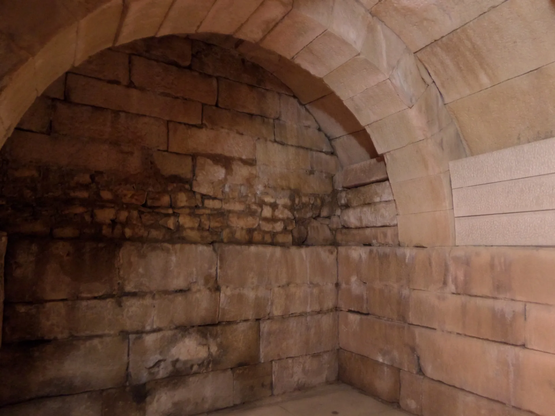
Roman mausoleum within the Radojković Tower complex in Škrip
Roman mausoleum within the Radojković Tower complex in Škrip · Gaius Cornelius · Wikimedia Commons · CC BY-SA 4.0 · licence

History and context

Škrip developed on the site of a hillfort settlement whose stone defensive walls can still be traced around the historic centre. Scholarly literature discusses Bronze Age layers, the Late Iron Age hillfort, and ancient and later finds. The archaeological zone is listed in the public register under reference RSTI-0649. The popular claim that Škrip was a Greek colony is unconfirmed and should not be repeated as fact.

What the site reveals

Beneath Radojković Tower is a Roman mausoleum dated in the literature to the 3rd century. Tradition associates it with Valeria and Prisca, the wife and daughter of Emperor Diocletian, but there is no secure evidence for this identification. The historic complex also contains ancient graves, sarcophagi and traces of other buildings; the present-day Muzej otoka Brača (Museum of the Island of Brač) occupies part of the historic complex.

Location and visiting

This record covers the wider archaeological complex in the centre of Škrip, so the pin is a guide rather than a precise marker for all the remains. Part of the site is beside the cemetery, museum spaces and private property. Follow local signs and the institution's current guidance when visiting the museum and accessing individual areas.


Visitor contributions

Do you know more about this entry?

A photo, an old postcard, a source link or local knowledge can help make the atlas more complete.

Schematic map of Brač with place markers

Every contribution is reviewed before publication.

Religious buildings
4 places

Separate map · local production

Find local producers

A map of family farms and other local producers on Brač. Browse by product type — olive oil, honey, cheese, cosmetics and more — and find basic information, contacts and official websites.

Open the producers’ map →
Local knowledge · Explore Brač

Help document Brač.

Do you know an old name, have a photo, know the location or have a source to share? Your contribution can enrich the island’s public atlas.

Suggest a connection between places →
Schematic illustration of a map with place markers
MOJ BRAČ · SECURE SIGN-IN

Sign in to Explore Brač

We send a one-time code to your email so you can save favourites. You do not need a password or separate registration. Your email and favourites list are stored in the Atlas database.