
Summary
Duboki dolac is a pronounced, enclosed depression in the wooded part of Vidova gora. It lies on the route towards Trolokve and is recognisable by the marked difference in elevation between its rim and grassy floor.
A closed karst depression on the Vidova gora–Trolokve route; the map marker refers to the entire dolac.
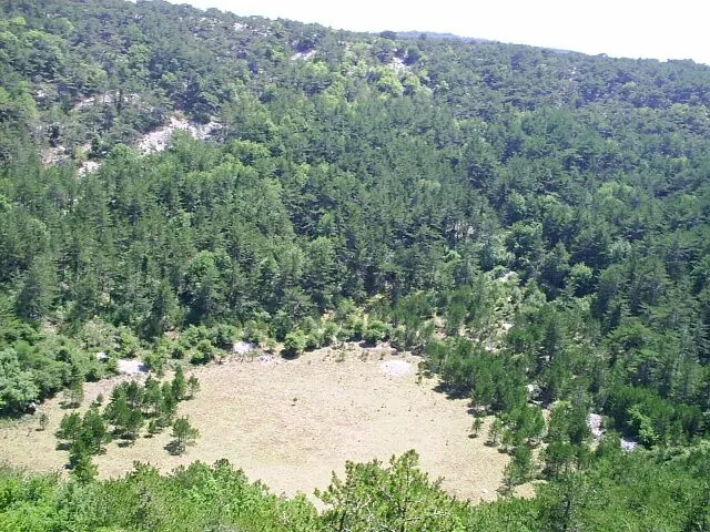
A depression in the karst plateau
OpenStreetMap identifies Duboki dolac as a doline, or enclosed karst depression. The Municipality of Nerežišća lists it among the important natural sites in its area. Its value is primarily geomorphological: the shape of the depression is visible within the wooded landscape.
A conservation study for Dol on Brač places Duboki dolac within the landscape of Vidova gora and proposes special geomorphological protection for it. That proposal is not proof that the site has since been separately designated a nature monument.
Views from the road towards Trolokve
The official description of the Bol route says it passes by Duboki dolac and Trolokve. The route thus connects the wooded terrain with the more open pastoral part of the plateau. In the photograph, the wooded slopes and open floor of the depression are clearly distinct.
Older route descriptions mention a hunting-ground fence beside the depression. Respect the fence and any marked access restrictions; do not assume the bottom of the doline is freely accessible from the hiking trail.
Access and visiting
View the depression from a safe section of the existing road. Do not approach the rim through dense vegetation or descend the steep slopes. Since similar names occur in other Croatian mountains, check that your chosen location is on Brač when planning your visit.

